

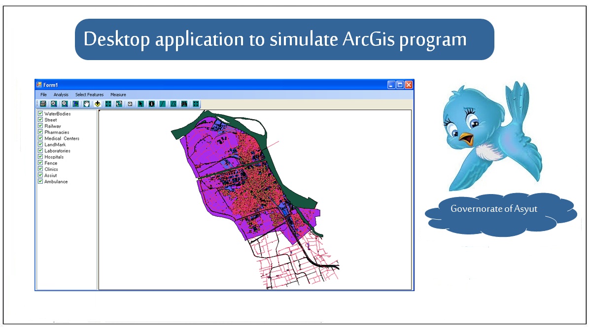
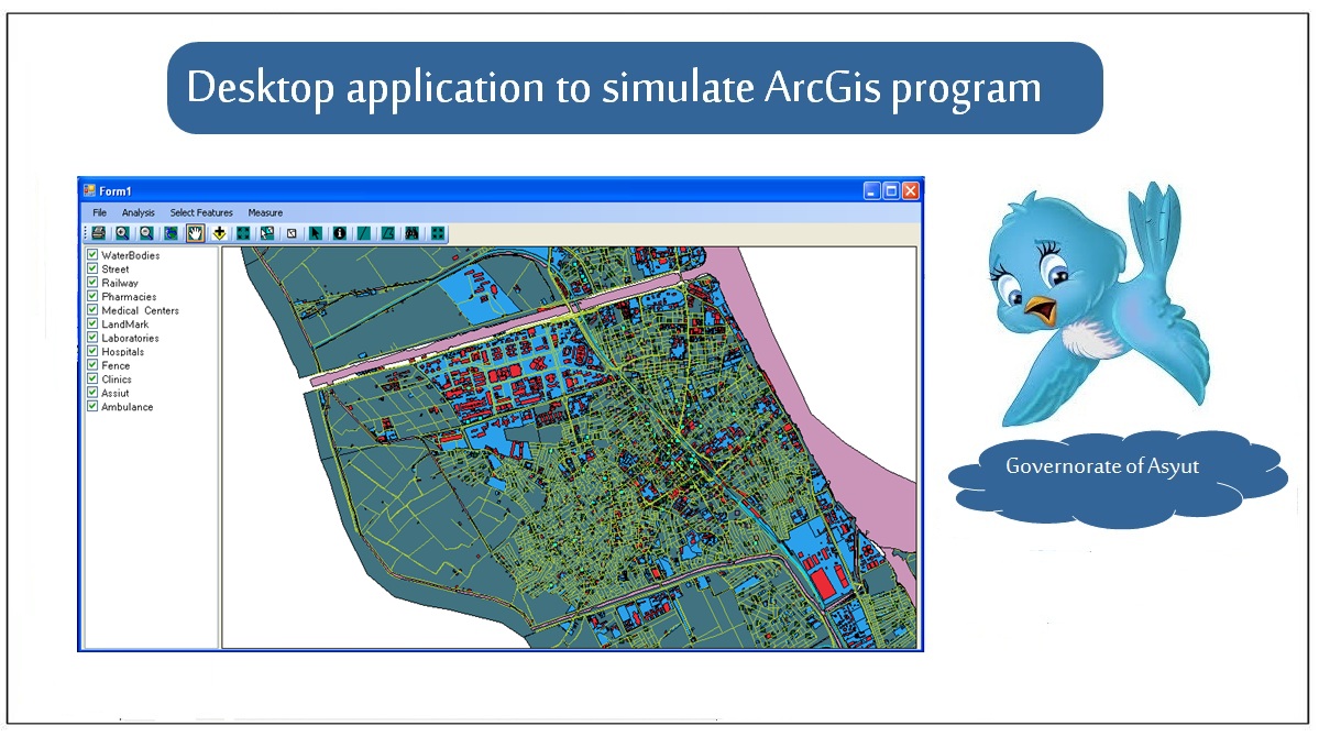

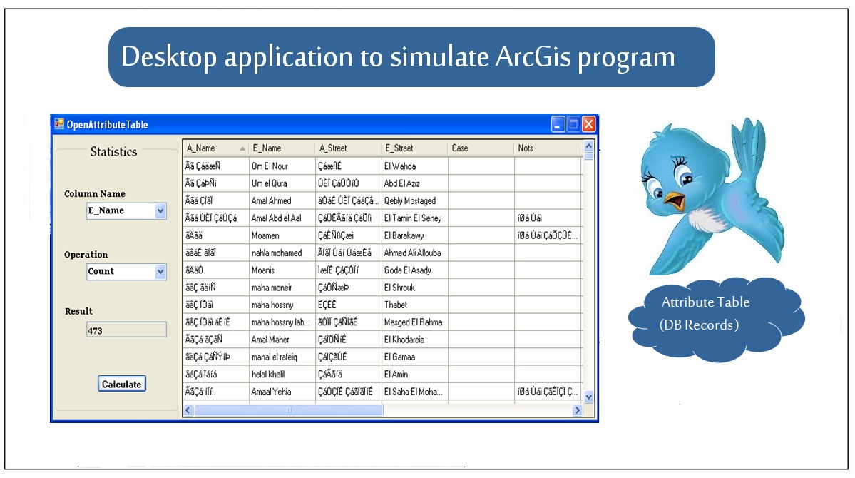
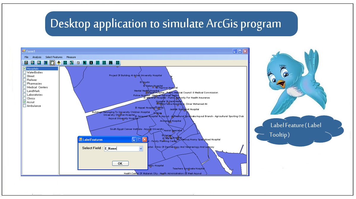
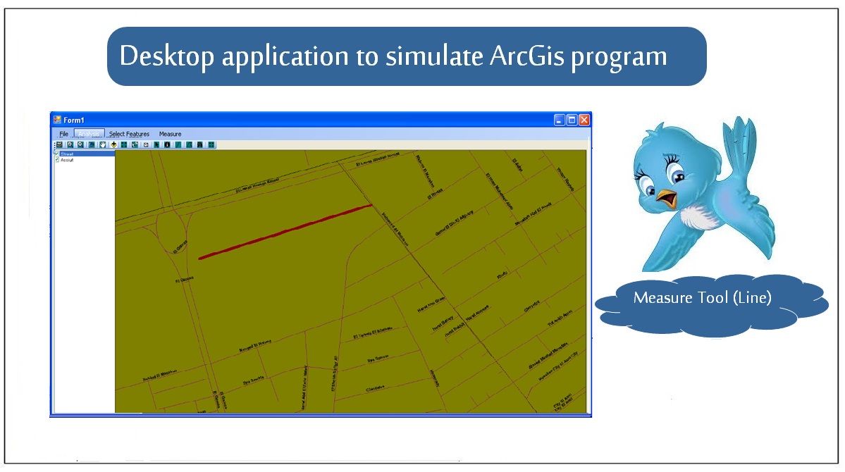
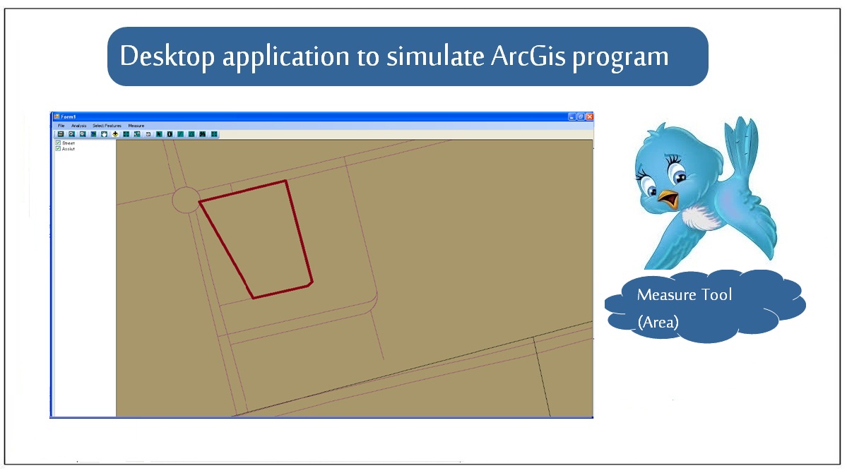
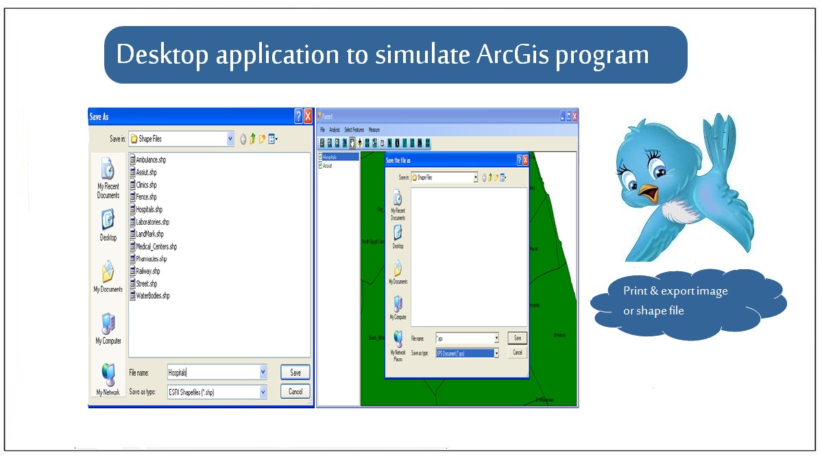
Simulation for ArcGis program
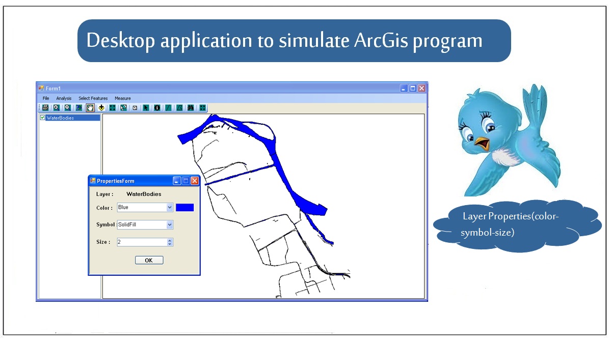
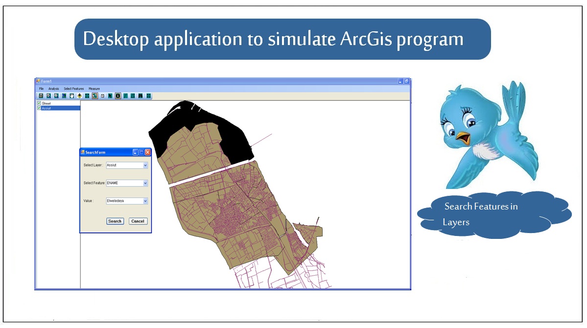
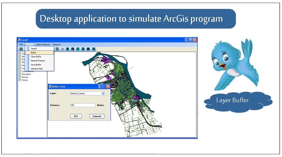
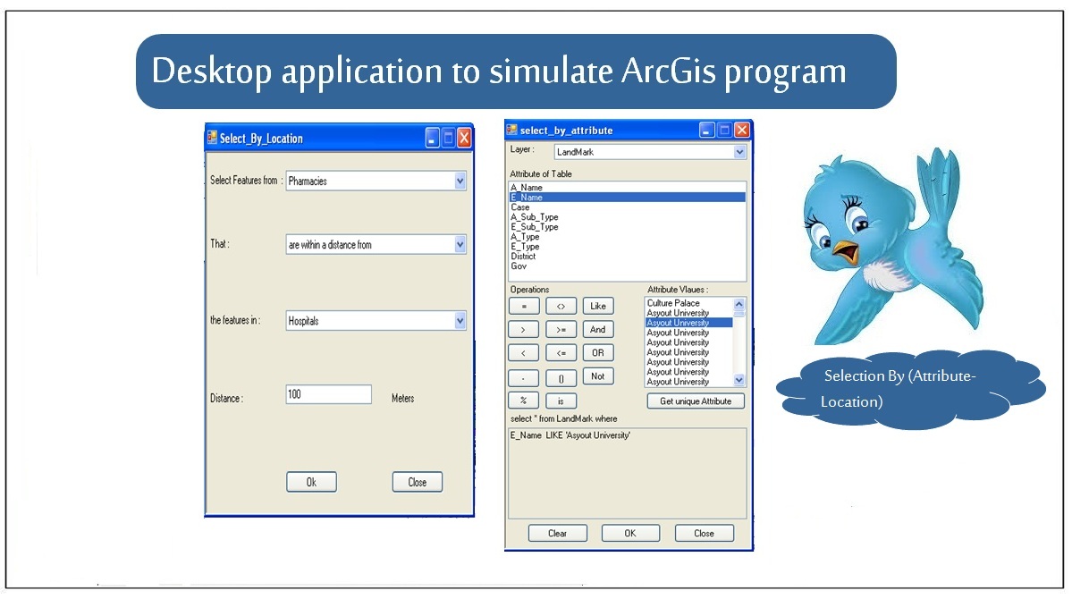
An application that simulates the ArcGIS program that provides dealing with maps, so that the user can add, remove, visualize layers and perform many operations and statistics on maps(global searching - selecting-buffering - measuring - identifying features - changing layer properties and export images or shape files).